Skip to content
Go back
menu
Visit & Explore
Aspiring Cross-Channel UNESCO Global Geopark
Aspiring Cross-Channel UNESCO Global Geopark
Save Aspiring Cross-Channel UNESCO Global Geopark to favourites
GeoAdventures
Save GeoAdventures to favourites
Geosites
Save Geosites to favourites
Cross-Channel Geopark Festival
Save Cross-Channel Geopark Festival to favourites
SALT + EARTH Festival
Save SALT + EARTH Festival to favourites
Activities
Walking
Cycling
Horse Riding
View all
activities
Places to Visit
Beaches
Parks & Open Spaces
Woodland
Rivers & Lakes
Outdoor Gyms
View all
places
Experiences & Itineraries
Culture & Heritage
Arts & Crafts
Wellbeing
Food & Drink
Family Fun
Wildlife & Nature
Pilgrimage
Outdoor Activities
Farming & Animals
View all
Experiences and Itineraries
Events
The North Downs Way National Trail
The North Downs Way National Trail
Save The North Downs Way National Trail to favourites
North Downs Way Rail Trails
Save North Downs Way Rail Trails to favourites
North Downs Way Art Trail
Save North Downs Way Art Trail to favourites
How to get here
Respect, Protect, Enjoy
Save Respect, Protect, Enjoy to favourites
News & Blogs
Landscape management
Landscape management
Farming in Protected Landscapes
Management guidance and publications
Kent Downs Management Plan Review 2026 – 2031
Management guidance and publications
Management Plan
Landscape Character Assessment 2020
Tree Planting
Natural Flood Management
Viticulture in the Kent Downs
Climate Change and the Kent Downs
Planning
Planning overview
Planning protocol
Planning publications
National Planning Policy Framework
Planning and the Management Plan
Boundary Map
New Duty to Seek to Further
Projects
Funding and Grants
Projects
UNESCO Sites Across the Channel
GeoDiversity
Putting Down Routes
Mapping Heritage Ponds
Protect Our Pollinators – Making Trapping Happen
Hidden Hollows Project
Farming in Protected Landscapes
Farming in Protected Landscapes: Indicative Projects
Discover the Darent Valley Landscape Partnership Legacy
North Kent Woods and Downs National Nature Reserve (NNR)
Undergrounding
The Kent Downs Trust
Past projects
EXPERIENCE
Mid Kent Downs Countryside Partnership
Orchards for Everyone
The Ash Project
Valley of Visions
Green Pilgrimage
#UptheKentDowns
Resources
Business Resources
Work with us
Find a North Downs Way Ambassador
Education Resources
Education walks for children
Useful teaching materials
How to guides
Activity sheets
Geopark Education Resources
About us
About us
What is special about the Kent Downs?
What is a National Landscape?
Who we are
Joint Advisory Committee
National Landscape Partnership
Our partners
The National Landscape team
EU Funding
Boundary Map
Vacancies and Opportunities
Contact us
Volunteering
Donate
Show search
Show favourites
Close menu
Search form
Search website
Get results
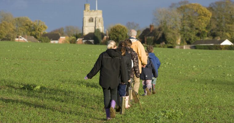
Greensand Way
3rd March 2015
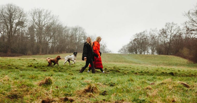
Stride out along 108 miles of the Greensand Way and discover some of the finest walking experiences in the South East.
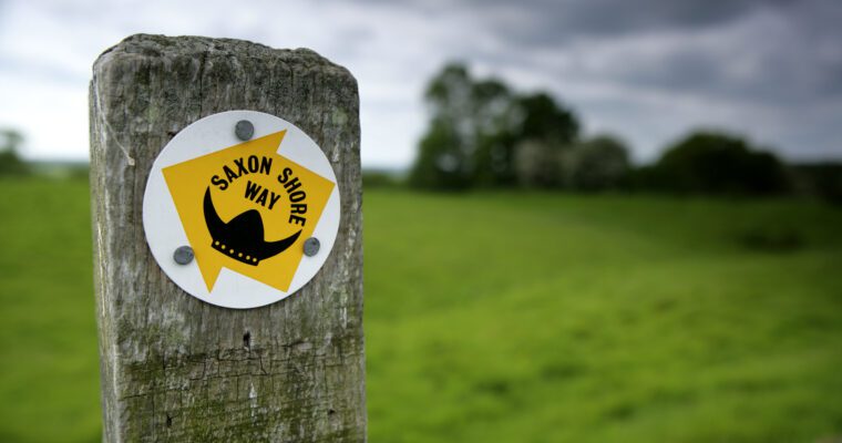
Saxon Shore Way
20th February 2015
Imagine stepping back in time and discovering the coastline of the Garden of England as it stood more than 1,600 years ago. The 160 mile…
Wealdway
18th February 2015
Follow the 82 mile Wealdway through the heart of the Kent and Sussex countryside, from the Thames Estury at Gravesend to the popular pier at…
Knole Stile Free Trail
17th February 2015
A walk of 3 miles (4.8km). Paths continually climb and descend throughout the walk. Admission to park is free. Parking charges apply. Opening times 10.30am…
Otford Walk
17th February 2015
Find yourself marvelling at the planets in one of Kent's most attractive villages with thriving inns, restaurants and independent shops. The distance of the walk…
Otford walk – landscapes and romance
17th February 2015
This peaceful and refreshing 5 mile walk starts by the river in the picturesque village of Otford and then climbs high above the valley to…
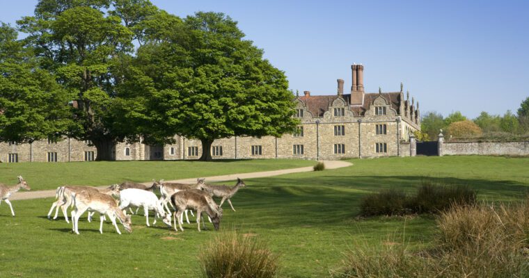
Lullingstone walk – butterflies and bees
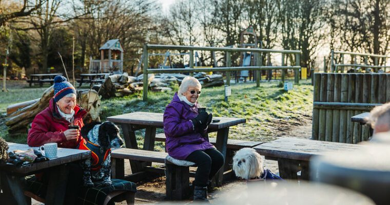
17th February 2015
Lullingstone Country Park Visitor Centre is packed with information about the many delights to be discovered along this walk and across the North Downs. This…
Sevenoaks walk – parkland and parakeets
17th February 2015
From the Leisure Centre follow the steep path and pass through the metal gate into Knole Park. This is your first chance to glimpse some…
Westerham Walk – Wonderfully Wild Woodland
17th February 2015
The small former market town of Westerham, with it's many independent shops, historic public houses and numerous restaurants and coffee houses is the ideal place…
Ide Hill walk – Peaceful Paths and Inspiring Hills
17th February 2015
Leave the picturesque green at Ide Hill – the highest village in Kent – and follow the path to the first stile to join the…
Camer Park Stile Free Trail
17th February 2015
A linear walk of 1.25 miles (2km). The path surface across the park is short grass followed by a hardened surface with occasional stones up…
Wilmay Copse
17th February 2015
An important feature of the local downland landscape, Wilmay Copse is an area of woodland overlooking Fawkham Valley from a high plateau.
1
You're on page
2
3
Back to top