Skip to content
Go back
menu
Visit & Explore
Aspiring Cross-Channel UNESCO Global Geopark
Aspiring Cross-Channel UNESCO Global Geopark
Save Aspiring Cross-Channel UNESCO Global Geopark to favourites
GeoAdventures
Save GeoAdventures to favourites
Geosites
Save Geosites to favourites
Cross-Channel Geopark Festival
Save Cross-Channel Geopark Festival to favourites
SALT + EARTH Festival
Save SALT + EARTH Festival to favourites
#UptheKentDowns
#UptheKentDowns
Save #UptheKentDowns to favourites
Top Downs
Save Top Downs to favourites
Settle Downs
Save Settle Downs to favourites
Activities
Walking
Cycling
Horse Riding
View all
activities
Places to Visit
Beaches
Parks & Open Spaces
Woodland
Rivers & Lakes
Outdoor Gyms
View all
places
Experiences & Itineraries
Culture & Heritage
Arts & Crafts
Wellbeing
Food & Drink
Family Fun
Wildlife & Nature
Pilgrimage
Outdoor Activities
Farming & Animals
View all
Experiences and Itineraries
The North Downs Way National Trail
The North Downs Way National Trail
Save The North Downs Way National Trail to favourites
North Downs Way Art Trail
Save North Downs Way Art Trail to favourites
Events
How to get here
Blog
Conserve
What is special about the Kent Downs?
Climate Change and the Kent Downs
New Duty to Seek to Further
Respect, Protect, Enjoy
Volunteering
Tree Planting
Landscape management
Farming in Protected Landscapes
Management guidance and publications
Kent Downs Management Plan Review 2026 – 2031
Management guidance and publications
Management Plan
Landscape Character Assessment 2020
Tree Planting
Natural Flood Management
Viticulture in the Kent Downs
Planning
Planning overview
Planning protocol
Planning publications
National Planning Policy Framework
Planning and the Management Plan
Boundary Map
Business Resources
Business Resources
Work with us
Find a North Downs Way Ambassador
Education
Education walks for children
Useful teaching materials
How to guides
Activity sheets
Geopark Education Resources
Projects
UNESCO Sites Across the Channel
GeoDiversity
Putting Down Routes
Mapping Heritage Ponds
Protect Our Pollinators – Making Trapping Happen
Farming in Protected Landscapes
Farming in Protected Landscapes
Farming in Protected Landscapes: Indicative Projects
Discover the Darent Valley Landscape Partnership Legacy
North Kent Woods and Downs
National Nature Reserve (NNR)
Undergrounding
The Kent Downs Trust
Past projects
EXPERIENCE
Mid Kent Downs Countryside Partnership
Orchards for Everyone
The Ash Project
Valley of Visions
Green Pilgrimage
About us
What is special about the Kent Downs?
What is a National Landscape?
Who we are
Joint Advisory Committee
National Landscape Partnership
Our partners
The National Landscape team
EU Funding
Boundary Map
Vacancies and Opportunities
Contact us
Donate
Show search
Show favourites
Close menu
Search form
Search website
Get results
Dover Museum and Maison Dieu
8th April 2024
Dover’s history has always been determined by its crucial location on the English Channel, just over twenty miles away from France and continental Europe.
Folkestone Museum
8th April 2024
Folkestone sits close to the middle of the Cross-Channel Geopark, and its coastal location has given rise to a rich history.
Shorne Woods Country Park
8th April 2024
Shorne Woods is a 300 acre country park between Gravesend and Strood with an interesting geological heritage.
Perry Wood
8th April 2024
Perry Wood in Selling is something of a geological anomaly in the Kent part of the Cross-Channel Geopark.
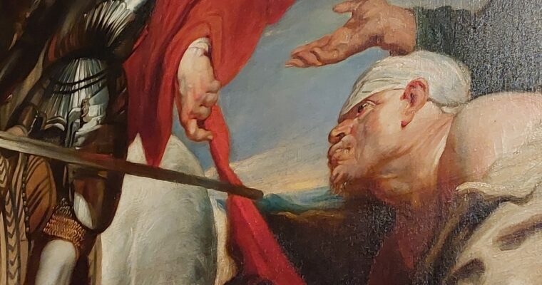
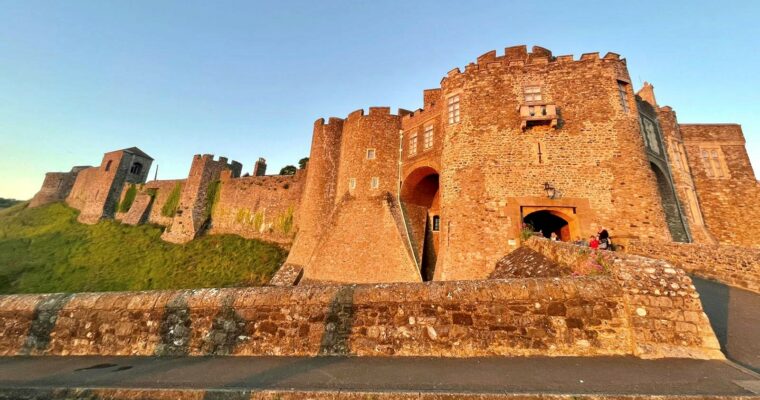
Dover Castle
4th April 2024
The most famous building in the Cross-Channel Geopark, Dover Castle has an extraordinary history stretching back at least to the Roman conquest of Britain nearly…
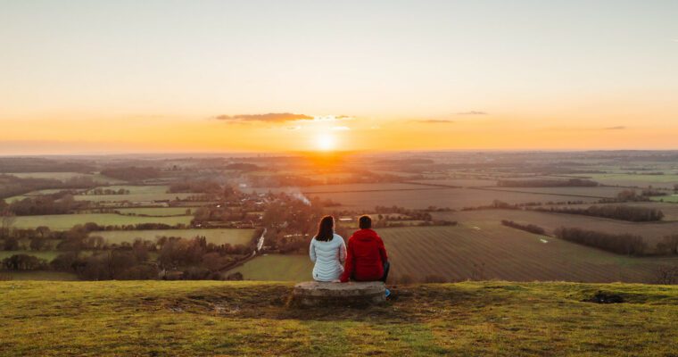
Devil’s Kneading Trough and the Wye Downs
4th April 2024
The Devil’s Kneading Trough is an extraordinary site of geological significance and the Wye Downs are a fantastic example of how geology impacts upon biodiversity.
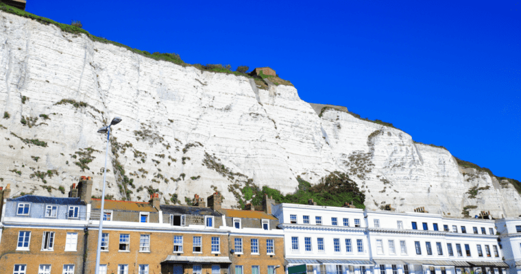
White Cliffs of Dover
4th April 2024
One of the most famous geological features in the world, the White Cliffs of Dover are also arguably the most iconic image of the British…
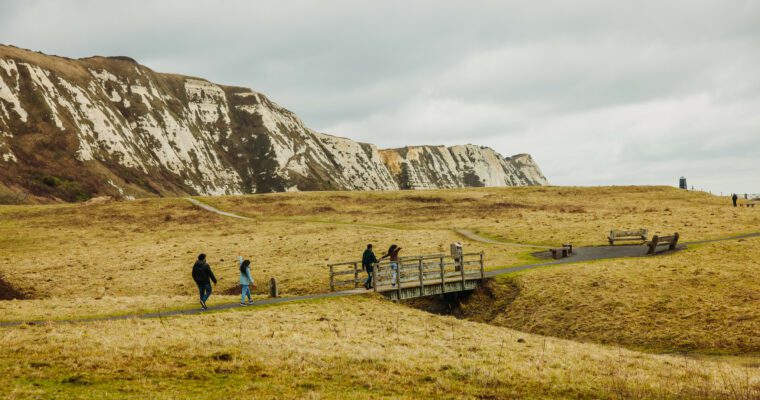
Folkestone Harbour, the Warren & Samphire Hoe
4th April 2024
The coastal area stretching from the eastern edge of Folkestone to the western edge of Dover is truly unique.
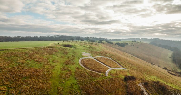
Chalk Monuments
4th April 2024
On the chalk hills of the Kent Downs there are four ‘hill figures’ carved into the slopes of the hills themselves.
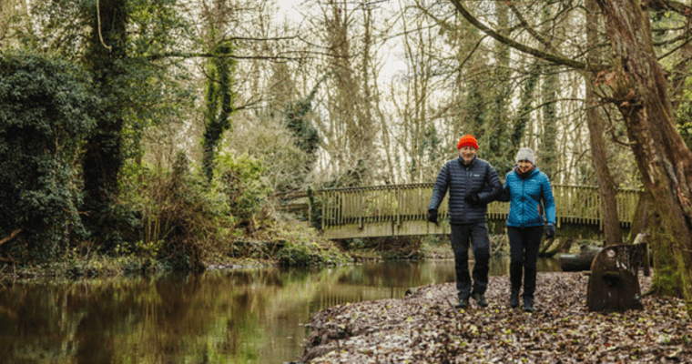
The River Darent
27th March 2024
There are only around 200 chalk streams in the world, so the Darent is an extremely unique and rare!
1
You're on page
2
Back to top