Devil’s Kneading Trough and the Wye Downs
The Devil’s Kneading Trough is an extraordinary site of geological and biological significance and the Wye Downs are a fantastic example of how geology impacts upon biodiversity.

Devil’s Kneading Trough and Wye Downs
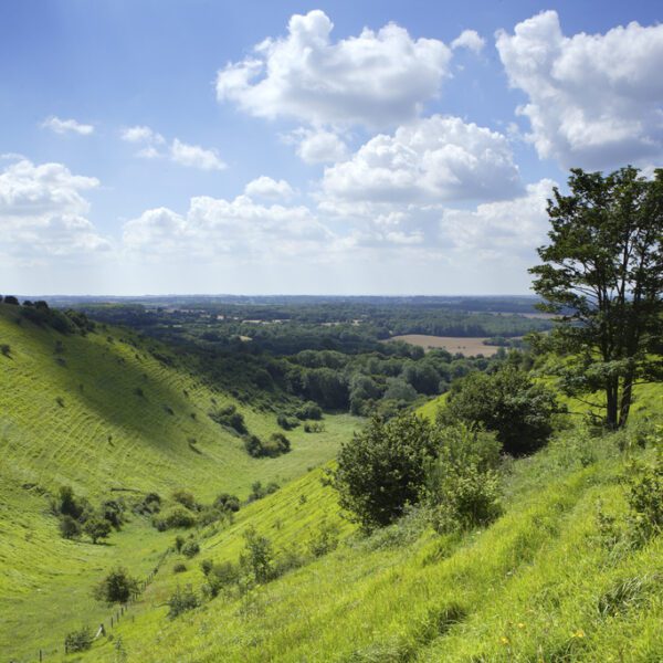
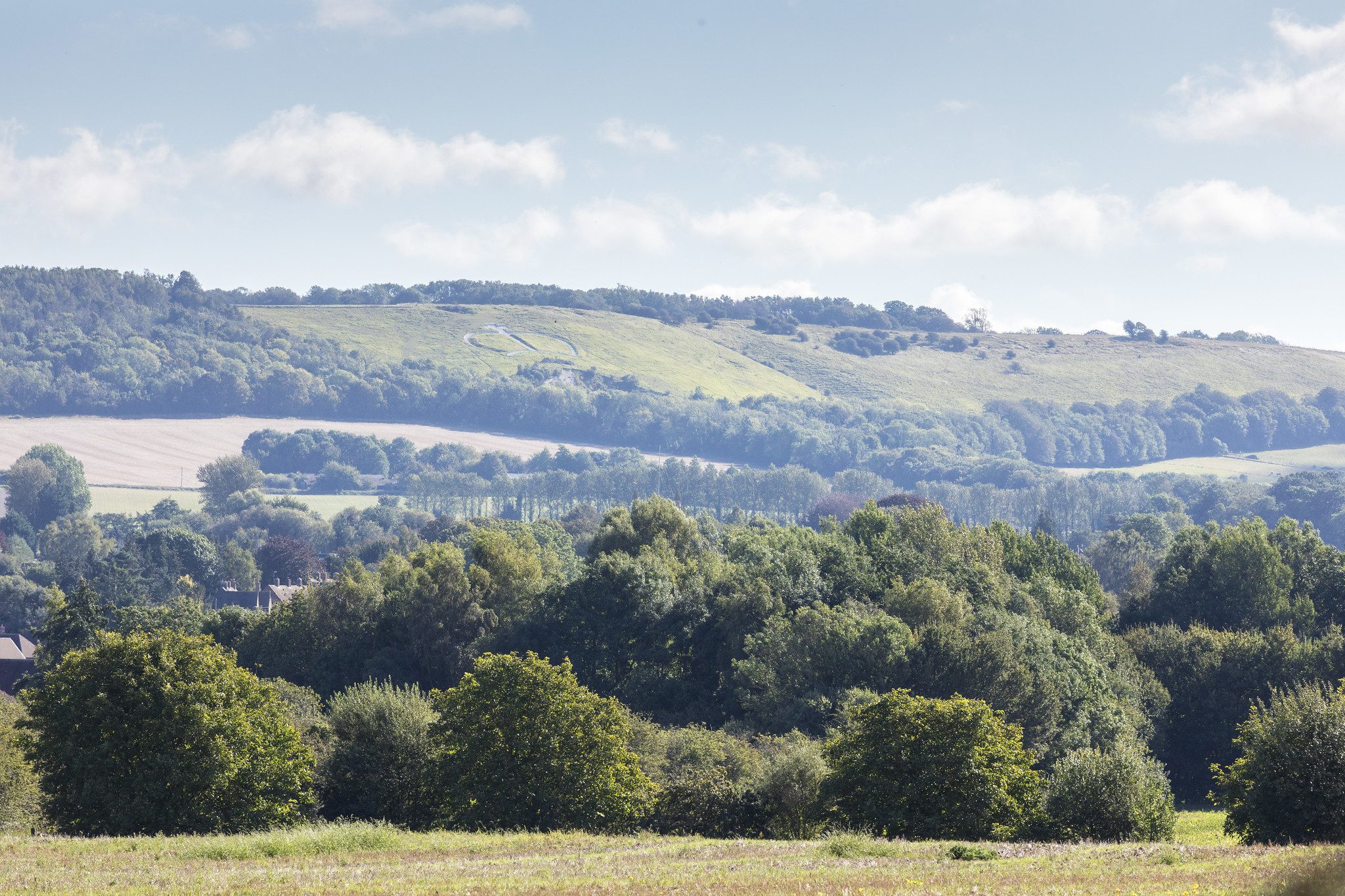
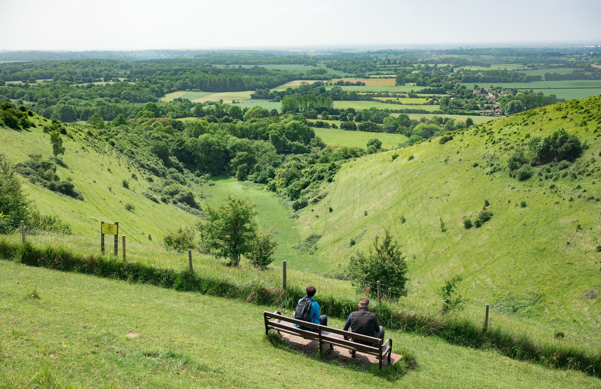
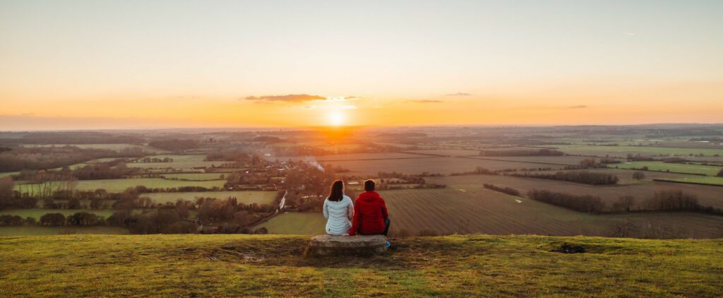
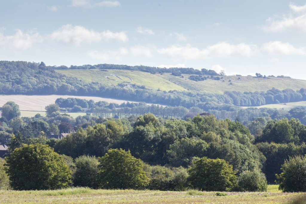
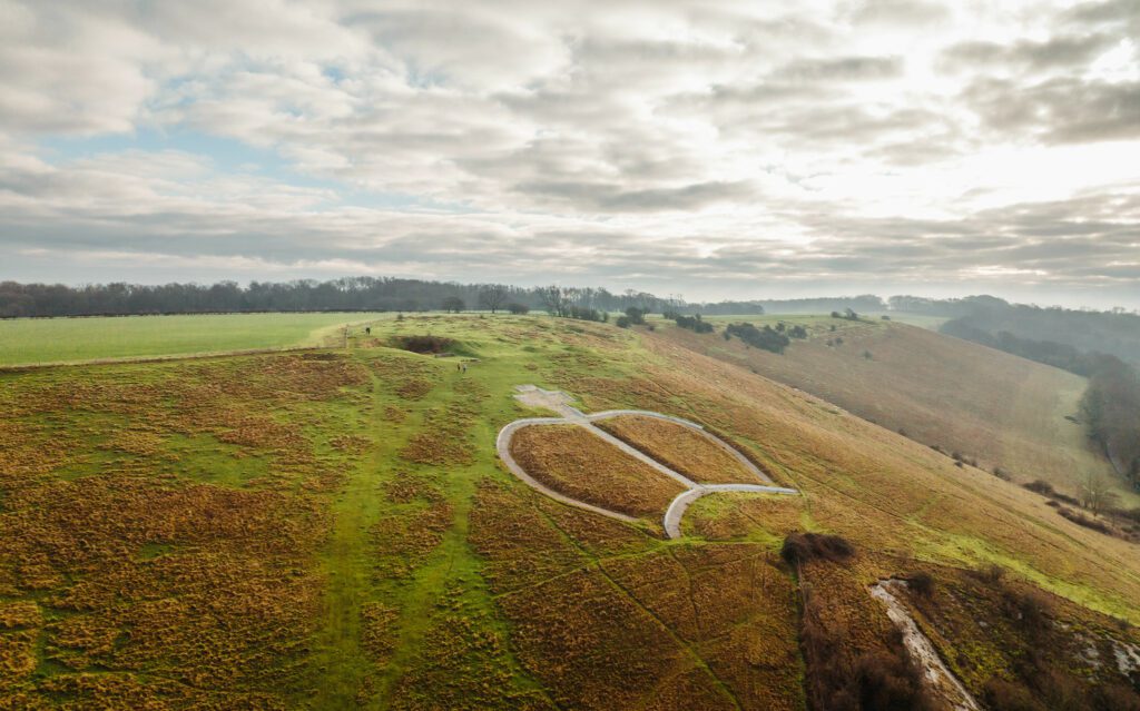
The Devil’s Kneading Trough is an extraordinary site of geological and biological significance, perhaps best known by locals for its stunning views out across the Weald all the way to Fairlight and the South Downs (on a very clear day anyway!).
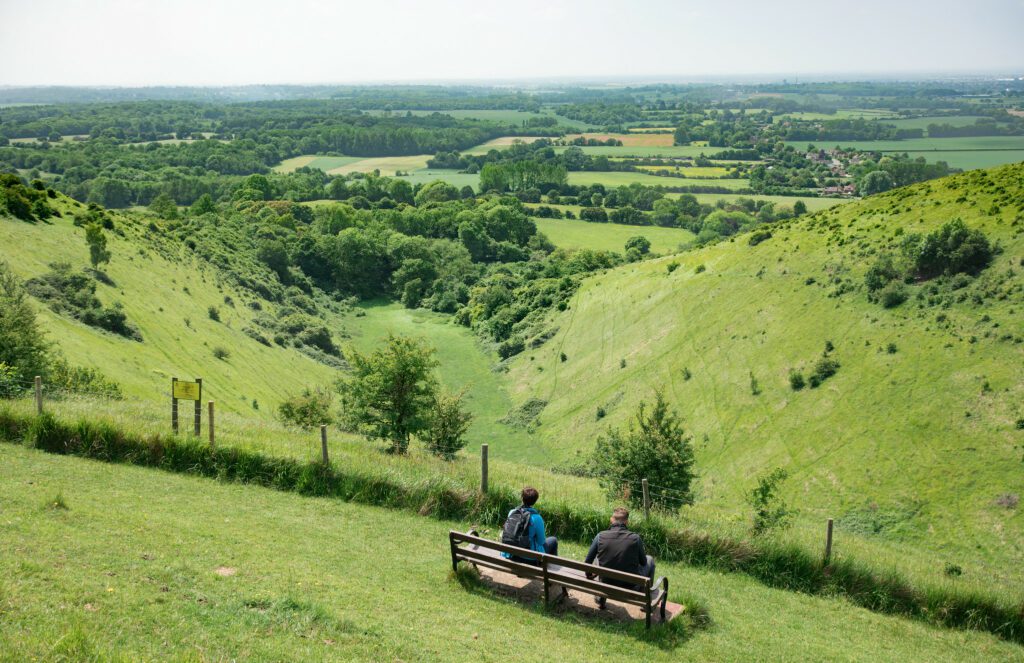
The ‘Trough’ in question here is in fact one of several steep-sided valleys formed at the end of the last ice age around 12,000 years ago.
The Cross-Channel Geopark was just outside the reach of the glaciers during this period, meaning the ground would have been frozen and thawed as the seasons changed, this process is known as periglaciation. The Devil’s Kneading Trough and the six other valleys at this site are the products of a periglacial erosion process called solifluction – this is what makes this site geologically significant. Periglaciation and solifluction occur on Earth today in places such as Northern Canada and the Arctic Tundra.
Another geologically significant element of this site is the fact that you can look over the ‘Wealden Anticline’. This anticline is the wider geological structure that the Cross-Channel Geopark sits within and is connected by.
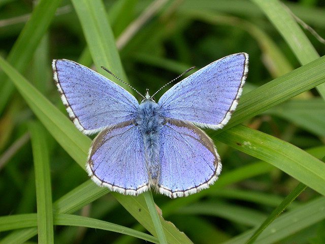
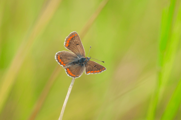
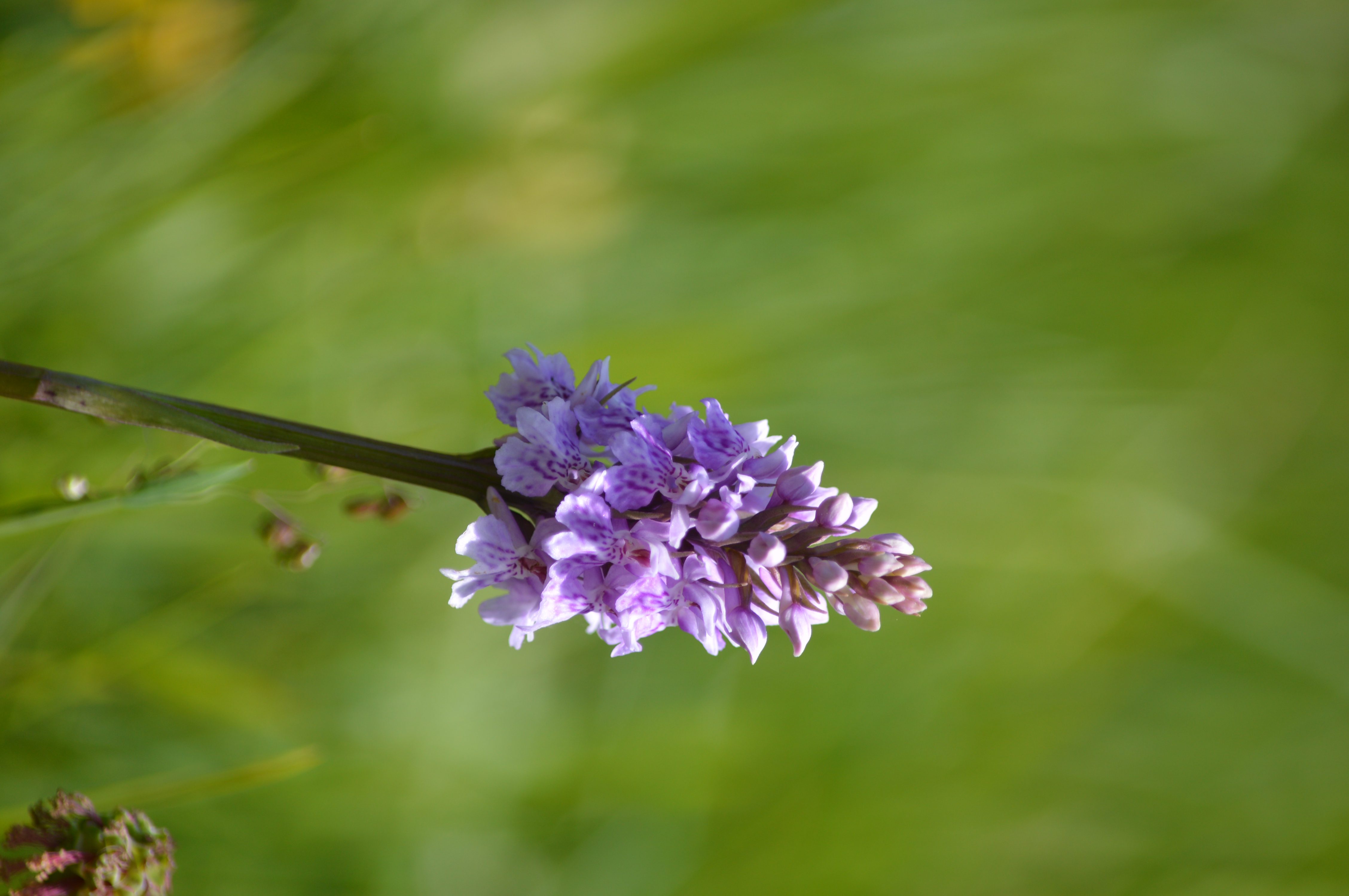
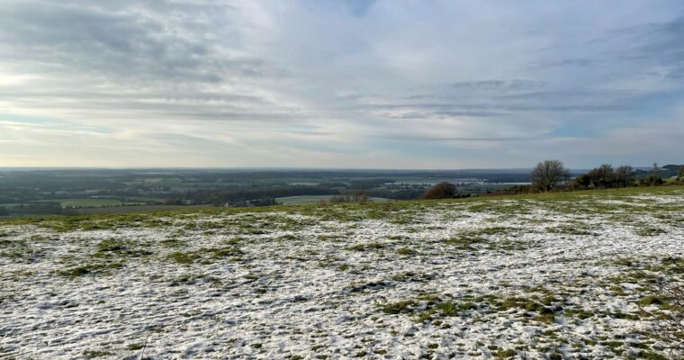
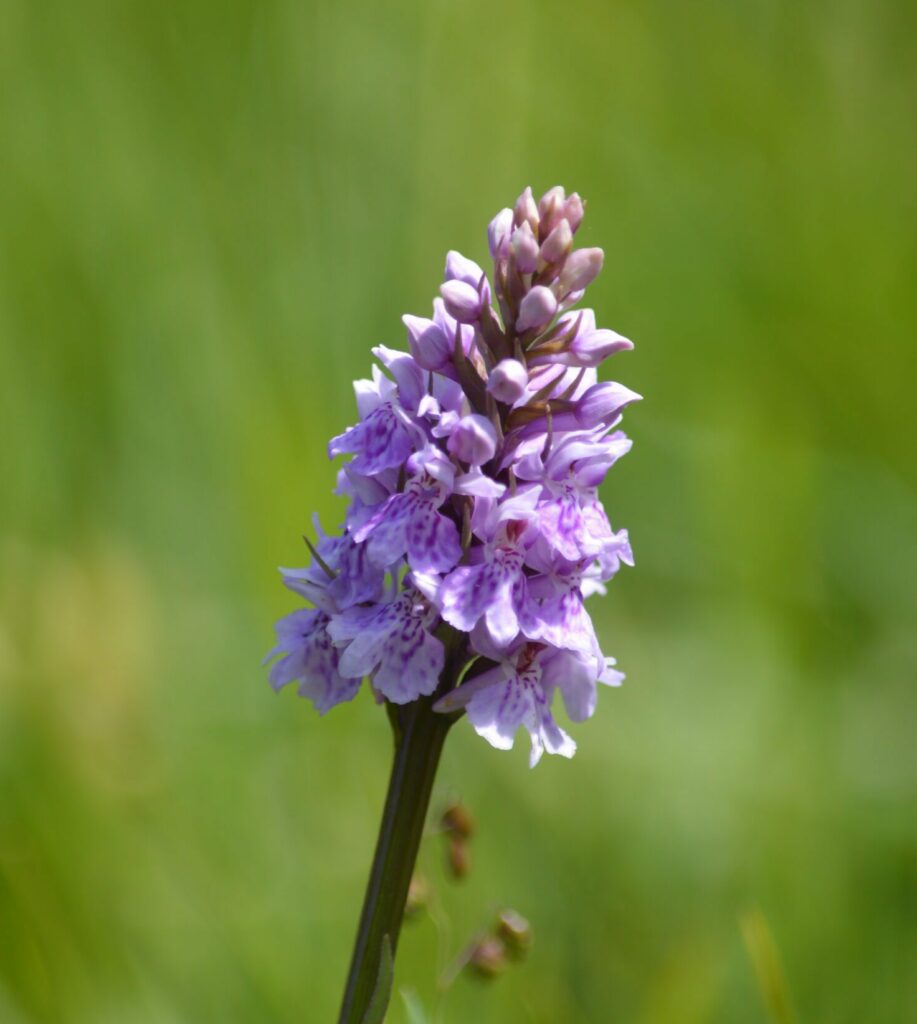
The Wye Downs are also a fantastic example of how geology impacts upon biodiversity, as the chalk that the hills here are made up of provides a habitat for all sorts of rare species that thrive on ‘chalk grassland’. These include orchids and butterflies that are found in very few other locations in Britain.
Chalk grassland sites such as this are the rarest habitats that we have in the English half of the Cross-Channel Geopark and are afforded many protections such as ‘Site of Special Scientific Interest (SSSI)’ and ‘Special Area of Conservation (SAC)’, which are the highest levels of legal protection afforded to nature sites in the UK.
About Geosites
Geosites are sites of geological interest across the aspiring UNESCO Cross-Channel Global Geopark, where people can visit and interact with our geological heritage. This wide range of sites will offer varying opportunities and values including cultural, heritage, scientific, educational, and aesthetic.
![]()
About the aspiring UNESCO Cross-Channel Global Geopark
Hundreds of thousands of years ago a catastrophic flood swept away the chalk ridge connecting Dover and Calais, carving out the white cliffs of Dover and starting Britain’s history as an island.
Did you know the Kent and French coasts are actually still connected today by the layer of chalk which runs below the Channel?
In celebration of the chalk and the channel, we are working to secure UNESCO Cross-Channel Global Geopark status for the Kent Downs National Landscape together with our neighbouring protected landscape in France; the Parc Naturel Regional des Caps et Marais d’Opale.
The Geopark will include both the protected landscapes and the Channel connecting them, recognising and celebrating the geological connection between us.