Charing to Hollingbourne – North Downs Way Rail Trail
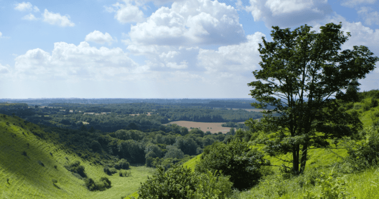
A 10 mile linear route with 4 train stations between Charing and Hollingbourne on the North Downs Way with options to shorten the route at Lenham or Harrietsham. Follow the ancient Pilgrims’ Way towards Canterbury on green lanes with gentle slopes and good surfaces for many users. Views up to the scarp of the North Downs and across farmland on the lower side. Passing through typical Kent villages with churches, cottages and local produce.
ROUTE STEPS
- From the main car park at Charing Station, turn left heading up Station Road into the village. Cross the A20 Ashford Road at the lights and continue ahead up the High St to The Hill. The Archbishop’s Palace and church are on the right, just off the High St.
- Keep ahead on this straight road climbing steadily uphill towards the A252 Charing Hill. Turn slight left to the safe crossing point and cross the road, bearing right towards Pilgrims Way.
- Turn left uphill into Pilgrims’ Way and left again at the top of the hill to come onto the North Downs Way and Pilgrims’ Cycle Route, heading towards Lenham, Harrietsham, and Hollingbourne. Follow this route in largely a straight line passing fields and crossing minor lanes on the way.
- After a short distance, pass a reservoir and water treatment plant and keep ahead on the main track. This route is a byway throughout, so keep an eye out for other users. With the gallops of Charing Racecourse below to the left and open farmland above to the right, keep ahead.
- At Hart Hill turn right uphill and then left, crossing the road to rejoin the main track running alongside a field edge. Keep ahead passing Cobham Farm to the left to Rayners Hill. For Cherry Downs Orchard and Picnic Site turn right uphill with the orchard on the right. For Lenham keep ahead.
- Keeping to the North Downs Way crossRaynersHill and pass a row of houses and keep ahead to Hubbards Hill.
- With care, turn left downhill fora short period, then cross the road to the right to rejoin the North Downs Way Byway at a horse stile/barrier. With the disused chalk pits above to the right, keep ahead towards Lenham Cross, passing the War Memorial on the right with the village below to the left. Passing another horse stile/barrier and passing houses to a junction at Faversham Road.
- For Lenham: turn left at the North Downs Way gateway sign down Faversham Road, carefully cross the A20 into the main village and follow the High Street to Station Approach Rd on the right.
For Harrietsham and Hollingbourne: keep right on Faversham Rd, following the road to the right and crossing the road onto the North Downs Way on the bend, into fields. Follow this track a short distance before meeting Pilgrims’ Way and keep ahead on the sealed surface towards Harrietsham.
- Pass the Marley Works on the left and come to the sculpture of Brother Percival at Pilgrims Rest – a sculpture of a monk snoozing on a bench, with a rest area adjacent tothe main track. Keep ahead to Stede Hill, crossing carefully, keeping ahead on the North Downs Way. Follow the route for a short distance to a bridleway on the left.
- For Harrietsham: turn downhill on the bridleway and follow this straight path downhill, bearing right at the fenceline to the station. For thevillage cross the footbridge over the tracks and follow the road into the village.
For Hollingbourne: keep ahead on the North Downs Way through open farmland on either side for some distance, ignoring paths to the left and right. Eventually, come onto a sealed surface on the outskirts of Hollingbourne Village.
- Keep ahead, passing the cricket club to the right to The Dirty Habit Pub at the crossroads.
- For Hollingbourne Station, turn left down Upper Street, bearing left on a bend until reaching All Saints Church. Bear right down the lane to the church. Keep right through the churchyard, through a gap and into a field with a surfaced path. Follow this path through fields to meet the road next to the school.
- At the wide gate at the end of this path, bear right through the width restrictor turning right heading downhill, away from the village on Eythorne St. Pass under the railway, then turn right up Station Approach. Keep ahead on this lane to Hollingbourne Station and the Signal Box Café.