Shoreham & Otford Circular – North Downs Way Rail Trail
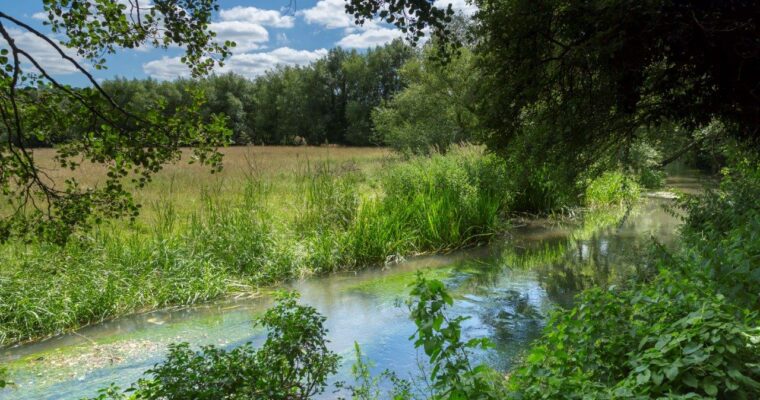
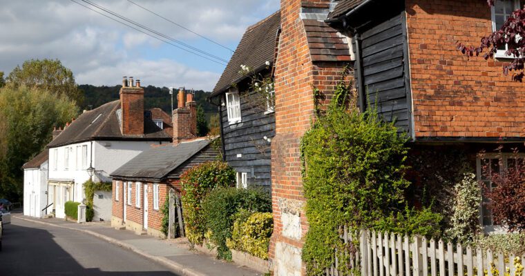
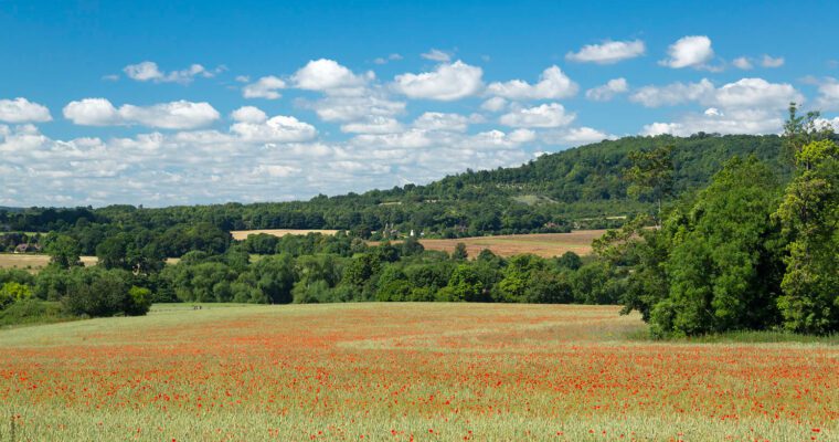
A five mile walk exploring the stunning countryside of the Darent Valley. The walk includes two historic villages as well as rare chalk grassland meadows, woodland and farmland. The route includes sections of the North Downs Way and the Darent Valley Path. The Shoreham and Otford area offers a rich blend of history and natural beauty, from the historic cricket field in Shoreham, where the game has been played since 1668, to the charming village itself with its medieval church, picturesque bridge and links to artist Samuel Palmer. The route follows the Darent Valley Path along the River Darent and passes through Otford, home to the Archbishop’s Palace, heritage trail and a listed duck pond. It also features scenic viewpoints such as Otford Mount, alongside important chalk grassland habitats like White Hill and Fackenden Down, which support a wide range of wildlife including butterflies, orchids and reptiles.
Walk Details
Terrain: Mainly fields and tracks with some steep slopes. Several roads and one fairway crossing.
Warning: Take care when crossing golf course fairways.
Views: Extensive and far-reaching views across the Darent Valley and beyond.
Refreshments: Numerous pubs and cafes in both Otford and Shoreham.
Toilets: Toilets at Otford Station. Toilets including accessible toilets at Shoreham and Otford Village Halls.
Route Directions
1. Exit Shoreham Station by descending the steps behind Platform 1. Turn right onto Station Road at the bottom of the steps and continue until arriving at a footpath on the left, a short distance after the golf club.
2. Leave the road at this footpath (Darent Valley Path) and continue, crossing a fairway and a cricket ground until reaching a lane.
3. Turn right onto a lane and after around 200m, take the Darent Valley Path on the left. Follow this path until reaching a gate to a field and continue until reaching another gate joining a farm track.
4. Cross the track and go through another gate into a field (still following the Darent Valley Path). The path slopes gently downward until reaching a gate. Enter the field and continue to follow the path, keeping the river to the right until reaching another gate at the far end. Pass by some allotments and an oast house before reaching a road.
5. This is the North Downs Way. Carefully cross the road and turn left towards Otford Village, keeping straight ahead and bearing slightly left at the duck pond until reaching Otford Station (at some point along this stretch, cross the road again due to lack of pavement).
6. To continue on this walk, cross the road when reaching Otford Station and continue uphill until reaching a junction. Bear right just before this and after a short distance, look for the North Downs Way signposted driveway on the opposite side of the road. Cross carefully and follow this as it climbs steadily and often steeply uphill.
7. Continue uphill leaving the houses and fences behind. The path becomes wider and more open. On reaching a bench, take time to rest and admire the views across the Darent Valley and beyond. The path continues uphill then starts to level off to reach a gate.
8. Continue a short distance to reach a field. At this point, leave the North Downs Way by aiming for a stile in the top left corner of the field in the direction of a trig point rather than continuing straight ahead. Turn left onto the lane and continue for around 500m.
9. On reaching a sharp bend in the road at Stursdon Farm, keep ahead through a gate and continue until the end of this path. Here there are fine views over Otford and Sevenoaks. Go through the gate and continue ahead with the far-reaching views to the south.
10. Go through the gate at the end of the open access land and enter a small section of woodland. Follow the path down to the left. Continue downhill until two footpaths cross about halfway down.
11. Turn right onto the footpath, which bisects Fackenden Down Nature Reserve.
12. Continue until reaching a lane and exit the reserve, bearing right and uphill. After around 200m, look for a vehicle barrier on the left and duck under this, following the path through more chalk downland to the road and the station opposite.