Unearthing Kent’s Hidden Ponds…
27th August 2024
We’re thrilled to share some exciting progress on our Kent Downs Heritage Ponds Project, which has been making remarkable strides thanks to the fantastic support of our volunteers and the local community. Just four months in, this FiPL-funded initiative is already bringing Kent’s hidden aquatic treasures back into the light—and it’s all happening with your help!
Mapping Kent’s Lost Ponds
Since the project began, a dedicated team of 50 volunteers has been hard at work mapping pre-1900 dew ponds and sole ponds across the Kent Downs. Thanks to their efforts, so far, we’ve documented over 350 ponds on the Kent LiDAR portal—a vital resource that not only aids our restoration efforts but also feeds into Kent County Council’s Heritage Environment Records. Our ultimate goal? To restore at least 20 of these ponds in the next phase of the project, breathing new life into these historic features.
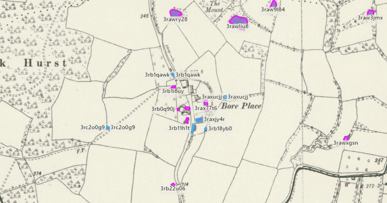
A Visit to Bore Place
This month, Project Manager Sally Evans and Heritage Ponds Officer Sarah Harrington-James paid a visit to one of our most promising sites yet: Bore Place estate in Chiddingstone. This organic regenerative dairy farm, home to The Commonwork Charitable Trust, boasts a rich history intertwined with the landscape. Among the 26 old ponds scattered across Bore Place, 17 are within the Area of Outstanding Natural Beauty (AONB), many of which lie within the original farmstead boundary.
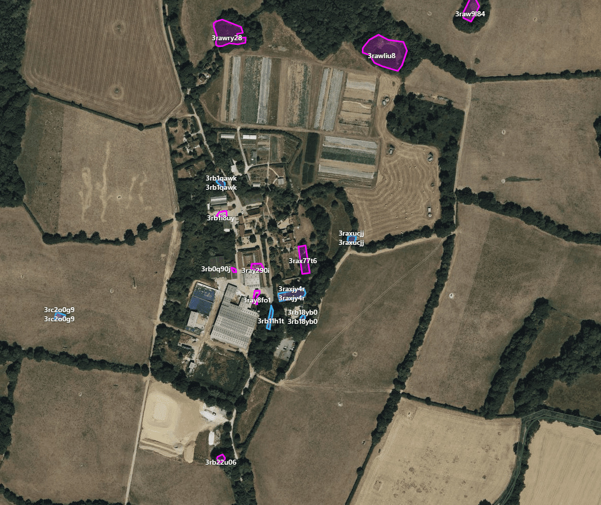
While some of these ponds have been lost to time, buried under buildings or hardstanding, Sally, Sarah, and Bore Place’s Heather Dickie struck gold during their visit. They uncovered three “ghost ponds” once ranging in size from 85m² to 137m². These hidden gems were revealed using a combination of old maps, aerial photos, and 1m LiDAR data, proving just how invaluable these tools are in our quest to rediscover Kent’s lost ponds.
The Importance of Restoration
Many of these historic ponds were originally dug to provide water for livestock, but over the decades, they’ve become silted up, overtaken by scrub, or filled in as farming practices evolved. Now, with a little TLC, we hope to bring them back to their former glory. At Bore Place, Sarah and Sally identified two existing ponds that could benefit from some maintenance, including removing silt and allowing more light to reach the water. This work is particularly important as the area is a hotspot for the Great Crested Newt, our largest native newt and a European Protected Species. Restoring these ponds could create ideal breeding grounds for these aquatic creatures and support a wider range of wildlife in the area.

Uncovering More History
While delving into Bore Place’s historic ponds, we stumbled upon something rather interesting. The second edition Ordnance Survey of 1899-1900 reveals two large, rectangular ghost ponds next to the Grade II Listed Bore Place manor house. Given that the current house dates back to 1745, we believe these ponds might have been dug to harvest clay for brickmaking. But if you have any other theories, we’d love to hear them!
Get Involved
There’s still plenty of time to join our journey of discovery. Whether you’re interested in uncovering the history of your local parish or simply curious about the past, we’d love for you to get involved. Drop us a line at: heritageponds@kentdowns.org.uk, and let’s continue to uncover the hidden gems of the Kent Downs together.
Popular articles
The Best Viewpoints in the Kent Downs
Searching for incredible views? Look no further! We've rounded up the best…
Top 6 bluebell walks in the Kent Downs
If you're looking for inspiration on the best places for some bluebell…
Lambing season in the Kent Downs
Discover the importance of lambing season in the Kent Downs and find…