The walk begins in Shorne Woods Country Park and leads through the historic villages of Cobham and Luddesdown. The landscape varies between woodland and beautiful views over open countryside and passes the imposing Darnley Mausoleum.
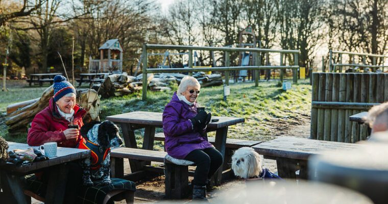
Throughout Shorne Woods Country Park you’ll find a range of wild flowers, fungi, reptiles and birds in amongst the wetlands, sweeping meadows and woodland.
The Grade II mausoleum along the way was built in 1786 for the 3rd Earl of Darnley. Darnley commissioned the architect James Wyatt to build the lavish tomb after it was declared that Westminster Abbey’s vaults were full, yet it was never used for burial.
Step by step guide
Leave the Visitor Centre towards the main entrance. Turn right just before the main gate and follow the path through the woodland to a kissing gate next to Brewers Road. Turn right and follow footpath across the A2 bridge to the roundabout. Beware of traffic. Cross Brewers Road, then cross Halfpence Lane.
Enter Ashenbank Wood through a kissing gate ahead of you. Follow the way marked route through Ashenbank Wood and pass through the remains of a WW2 camp.
Fork left after the camp and head downhill then along a field boundary underneath some towering Chestnut trees.
Turn right at the fence at the bottom of the hill, next to an interpretation panel. Go through the kissing gate and turn left. Follow the field boundary and footpath heading towards Cobham Church keeping an orchard on your left. Go straight ahead through a kissing gate with a sports field to your left. When you reach the tarmac main road through Cobham, turn left and follow the footpath up to the Leather Bottle pub. (For an alternative shorter route follow the main road through Cobham up to the roundabout and then follow Lodge Lane up to the Mausoleum and continue from point 18). Cross over the road and go into the churchyard. Follow the path keeping the church on your left, downhill and through another graveyard.
Cross a stile into a field with an orchard on your right hand side. Follow field boundary down to road, then turn left across a railway bridge.
Just before a house, turn right onto a footpath following a field boundary.
Cross over a stile to your left, then through a kissing gate. Keep dogs on a lead as this field is used by horses. Leave the horse field through a second kissing gate and continue downhill towards the houses until you reach the road at Henley Street. At the road turn right and follow the road for approximately 80m. The white building in front of you at this point is The Cock public house.
Turn left onto a bridle path and follow it uphill until you reach a signed path junction at the very top.
Turn left and follow the Wealdway along the ridge and then down to the road at Luddesdown.
At the road turn left up to a triangle road junction. Turn right here and follow the road up onto a cobbled path. Continue straight ahead past the church towards the farm buildings.
Cross a stile on your left, then climb the hill and turn left over a stile. Head straight across the field then go through the hedge and turn left following the footpath along the field edge until you reach a road. Turn left at the road and head downhill past Luddesdown Organic Farm until you reach the car park of the Golden Lion pub.
From the pub, follow the road named Henley Street.
As the road bends left, enter the field to the right at the way mark sign. Head straight across the field, towards the wood.
Cross the stile into Cobhambury Wood. Turn right immediately after crossing the stile and follow the path to the next junction. Turn right and head downhill into dense woodland.
When you reach the road, turn to the left and head towards the phone mast on the hill.
Take the first right up a track passing close to the phone mast and then go underneath the railway. Continue uphill until you pass two field gates on your right.
10m further on, go through a small kissing gate on your right hand side and uphill through the woodland. Go through a kissing gate at the edge of the wood and then head straight across the field towards a large dead tree.
At the vehicle track, turn right onto Lodge Lane (the shorter walk rejoins here). Follow the track, ignoring all junctions until you reach the Darnley Mausoleum. Continue past the Mausoleum and head straight along the track that follows the ridge for about 200m.
Go through the kissing gate and after 30m turn left at the Ranscombe information board, heading downhill into woodland.
At the bottom of this path, next to Knights Place Farm, go straight ahead through two kissing gates into some more woodland. Follow this path to the bottom and then cross over a stile next to the railway line. Turn left and follow this path down to the road. Dogs should be kept on a lead for the rest of the walk.
Go through the gate, turn right underneath the railway and cross over the A2 road bridge. At the T junction, turn right.
After about 100m, turn right down a ramp into Brewers Wood. Follow the wide track through the wood and emerge at a pedestrian and horse crossing.
Turn left after crossing the road and return to Shorne Woods Country Park.